
Saturday 6 April 2013
Sunday 24 March 2013
OBJECTIVES
Assalamualaikum,
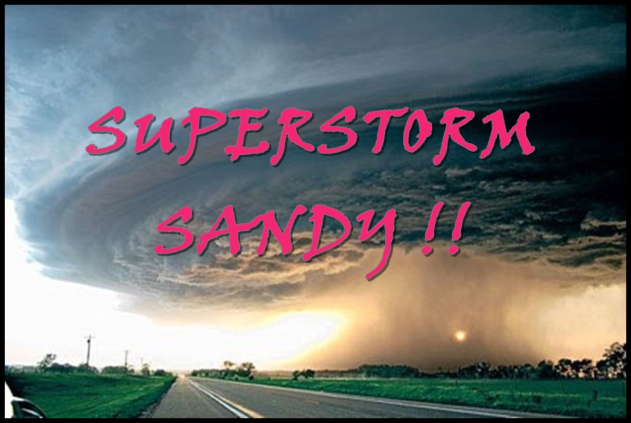
Hi ;) I am Nurauni Binti Mohd Noor from DEC 5B and this blog is done for Digital And Mobile Communication
subject that assigned by my lecturer, Madam Hawinda bt Karmon. Purpose I
created this blog to let the others know about the Hurricane Sandy.
The objective of this blog is to share information about what is Sandy, the categories and structure of Sandy. Then, to tell about the news and effects of Sandy. It also share the technology to use for early detection and what you need to do before, during and after Sandy. So, it will increase awareness in people so that they are alert to current situation and remember this history.
Thank
you for reading my blog, I hope that this blog can give a lot of information to
people out there about the natural disaster in the world ;) ♥
Hurricane in Action
REFERENCES
INTRODUCTION:
- Hurricane Sandy http://en.wikipedia.org/wiki/Hurricane_Sandy
- Meteorological history of Hurricane Sandy http://en.wikipedia.org/wiki/Meteorological_history_of_Hurricane_Sandy
- Hurricane: What Is a Hurricane? http://www.weather.com/outlook/weather-news/hurricanes/articles/hurricane-what-is-a-hurricane_2010-05-24
CATEGORIES:
- A hurricane's power http://www.palmbeachpost.com/news/weather/a-hurricanes-power-1/nLj7y/
- Hurricane: Saffir-Simpson Hurricane Wind Scale http://www.weather.com/outlook/weather-news/hurricanes/articles/hurricane-saffir-simpson-wind-scale_2010-05-24
STRUCTURE:
- Hurricane Structure http://www.enchantedlearning.com/subjects/weather/hurricane/anatomy.shtml
- Hurricanes: The Greatest Storms On Earth http://earthobservatory.nasa.gov/Features/Hurricanes/hurricanes_2.php
NEWS:
- How companies used social media during Hurricane Sandy http://www.guardian.co.uk/world/us-news-blog/2013/feb/20/mta-conedison-hurricane-sandy-social-media-week
- New York Aquarium on Coney Island, swamped by Hurricane Sandy, to reopen May 25 http://www.nydailynews.com/new-york/new-york-aquarium-coney-island-set-reopen-25-sea-lions-included-article-1.1308741
- Group helps young victims of Hurricane Sandy http://abclocal.go.com/wabc/story?section=news/local/new_york&id=9054376
EFFECTS:
- Superstorm leaves 16 dead and millions without power on America's east coast http://www.liverpoolecho.co.uk/liverpool-news/uk-world-news/2012/10/30/superstorm-leaves-16-dead-and-millions-without-power-on-america-s-east-coast-video-and-gallery-100252-32130116/
- Superstorm Sandy's impact on East Coast http://www.wptv.com/gallerys/news/news_photo_gallery/photos-east-coast-braces-for-hurricane-sandy_7963136#
TECHNOLOGIES FOR DETECTION:
- Technology Used to Understand Hurricanes http://www.nasa.gov/vision/earth/lookingatearth/technology_list.html
- Things People Use to Find Hurricanes http://www.ehow.com/info_8212500_things-people-use-hurricanes.html
WHAT TO DO:
- Hurricane Preparation Tips For Sandy Superstorm http://www.huffingtonpost.com/2012/10/27/hurricane-preparation-tips-sandy-storm-east-coast_n_2030570.html
- Hurricane Safety Tips http://www.facebook.com/pages/Hurricane-Sandy/506493399380778?fref=ts
WHAT IS SANDY
Sandy is a hurricane that is very powerful and becomes a hurricane when the magnetic force acts upon it and it starts spinning. It is becomes stronger when there is warm water so that is why it dies down when it hits the land. They can produce heavy rains, strong winds, and even produce tornadoes very easily because the winds are spinning.
Hurricane Sandy is seen churning over the Bahamas in this NASA handout satellite image taken on Oct. 25. (NASA)
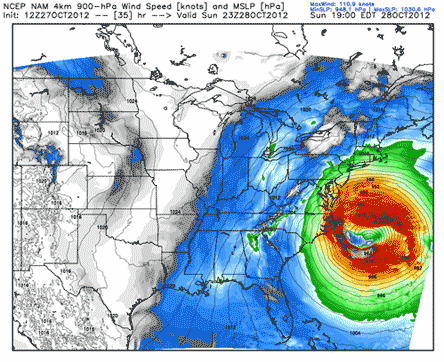
The meteorological history of Hurricane Sandy lasted for over a week in October 2012. Besides, hurricane Sandy was the eighteenth named storm and tenth hurricane of the 2012 Atlantic hurricane season. In the Atlantic/East Pacific Oceans, it is called a hurricane. In the West Pacific Ocean, it is a typhoon. In the Indian Ocean, it is known as a cyclone.
A hurricane starts as a tropical depression and progresses to more severe storms. The different stages are classified based on their sustained wind speeds. A powerful hurricane can kill more people and destroy more property than any other natural disaster.

People walk on a street littered with debris after Hurricane Sandy hit Santiago de Cuba on Oct. 26. (Desmond Boylan/Reuters)
For more information follow the link below:
CATEGORIES OF SANDY
NASA stated that Sandy is a categories 3 hurricane
Hurricanes have a few categories which are as stated below:

The Saffir-Simpson scale ranks hurricanes from Category 1 to Category 5, the most powerful.
Sandy was a Category 3 storm at its peak intensity when it made landfall in Cuba. While it was a Category 2 storm off the coast of the Northeastern United States, the storm became the largest Atlantic hurricane on record (as measured by diameter, with winds spanning 1,100 miles (1,800 km).
On October 25, Sandy hit Cuba as a Category 3 hurricane, and then weakened to a Category 1 hurricane. Most hurricanes only have well-formed and compact eyewalls at category 3 strength or higher. Sandy was not only barely a category 1 hurricane, but Sandy was also experiencing strong wind shear, Sandy was going over ocean typically too cold to form hurricanes, and Sandy had been limping along as a marginal hurricane for several days.
STRUCTURE OF SANDY
 |
| Hurricane Structure |
Hurricane winds blow in a counterclockwise spiral around the calm, roughly circular center called the eye. In the eye, which is roughly 20 to 30 miles wide, it is relatively calm and there is little or no rain. The eye is the warmest part of the storm.
Surrounding the eye is the eyewall, a wall of thunderclouds. The eyewall has the most rain and the strongest winds of the storm. The smaller the eye, the stronger the winds. The winds spiral in a counterclockwise direction into the storm's low-pressure center.
Long bands of rain clouds appear to spiral inward to the eyewall, these are called spiral rainbands. Hurricanes can be hundreds of miles across.

(TOP) The eye, eye wall and rain bands of hurricane
(MIDDLE) Mixture of cool (falling) and warm (rising) air (Graphics Copyright © National Center for Atmospheric Research/The COMET Program.)
The stronger the convection in the thunderstorms becomes, the more rain they produce. The more rain they produce, the more heat they release into the surrounding atmosphere, further fueling the storm.
For more specific explanation regarding the structure of Sandy, please visit:
NEWS OF SANDY
a. How companies used social media during Hurricane Sandy:

On 20 February 2013, companies discussed how information was shared online during the storm at a Social Media Week event in New York. As Hurricane Sandy approached the US in October last year hundreds of thousands of people used social media networks like Facebook and Twitter to keep abreast of the storm.
When the dust settled, people turned to those networks again to follow recovery efforts and find out transport information. Aaron Donovan, media liaison at the MTA, said the agency had focussed on Twitter, Flickr and YouTube in its Sandy response, but noted that "Twitter had the broadest pick up in a very immediate way".
b. New York Aquarium on Coney Island, swamped by Hurricane Sandy, to reopen May 25:
On 5 April 2013, Officials estimate Hurricane Sandy's floodwaters caused $65 million in damages, five of the aquarium's exhibits remain under repair. The New York Aquarium in Coney Island, devastated during Hurricane Sandy, has set a date to reopen and its famous sea lions will be out for the big day in May. Admission fees usually $15 for adults and $11 for kids will be “considerably reduced,” because to make up for the lack of five exhibits that remain closed while repairs continue.
When the dust settled, people turned to those networks again to follow recovery efforts and find out transport information. Aaron Donovan, media liaison at the MTA, said the agency had focussed on Twitter, Flickr and YouTube in its Sandy response, but noted that "Twitter had the broadest pick up in a very immediate way".
b. New York Aquarium on Coney Island, swamped by Hurricane Sandy, to reopen May 25:
 |
| New York Aquarium |
 |
| Floodwaters inundated the aquarium during Superstorm Sandy. |
c. Group helps young victims of Hurricane Sandy
On 5 April 2013, after Superstorm Sandy hit, many New York City students struggled with huge losses at home. Many of them had to live with friends or relatives, but a program in some schools called "Crew" helped a lot of students weather the storm. As part of the "Protect Our Children", it also found out how "Crew" is helping kids deal with stress.
Stories like this one were all too familiar at Channel View High School in the Rockaways after Superstorm Sandy. The crew program began in 2004. It begins with a weeklong wilderness experience that includes bonding and character building. So far, it's been very successful and it's an idea that could be used in more schools.
Subscribe to:
Posts (Atom)